
Evansdale topographic map
Interactive map
Click on the map to display elevation.
About this map
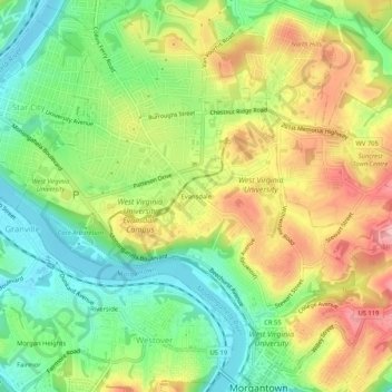
Name: Evansdale topographic map, elevation, terrain.
Average elevation: 1,014 ft
Minimum elevation: 791 ft
Maximum elevation: 1,296 ft
Other topographic maps
Click on a map to view its topography, its elevation and its terrain.
Fieldcrest
United States > West Virginia > Monongalia County > Morgantown
Fieldcrest, Morgantown, Monongalia County, West Virginia, 26505, United States
Average elevation: 1,138 ft