
Tällberg topographic map
Interactive map
Click on the map to display elevation.
About this map
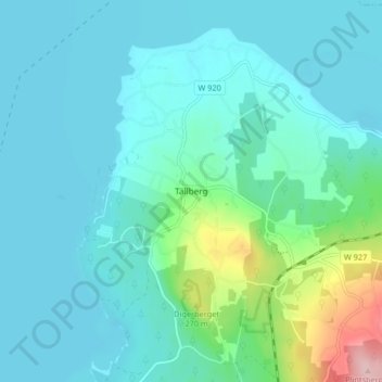
Name: Tällberg topographic map, elevation, terrain.
Average elevation: 627 ft
Minimum elevation: 522 ft
Maximum elevation: 1,178 ft
Other topographic maps
Click on a map to view its topography, its elevation and its terrain.
Östanhol
Sweden > Dalecarlia > Tällberg > Östanhol
Östanhol, Tällberg, Leksands kommun, Dalecarlia, Region Svealand, 793 70, Sweden
Average elevation: 630 ft