
Eger topographic map
Interactive map
Click on the map to display elevation.
About this map
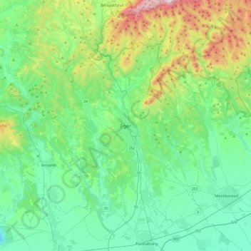
Name: Eger topographic map, elevation, terrain.
Location: Eger, Egri járás, Heves, Northern Hungary, 3300, Hungary (47.73899 20.21437 48.05899 20.53437)
Average elevation: 801 ft
Minimum elevation: 118 ft
Maximum elevation: 3,097 ft