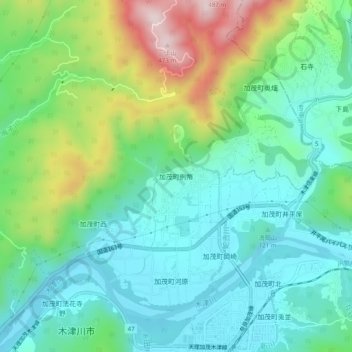
加茂町例幣 topographic map
Interactive map
Click on the map to display elevation.
About this map
Name: 加茂町例幣 topographic map, elevation, terrain.
Average elevation: 479 ft
Minimum elevation: 79 ft
Maximum elevation: 1,470 ft

Click on the map to display elevation.
Name: 加茂町例幣 topographic map, elevation, terrain.
Average elevation: 479 ft
Minimum elevation: 79 ft
Maximum elevation: 1,470 ft