
La Chiclana topographic map
Interactive map
Click on the map to display elevation.
About this map
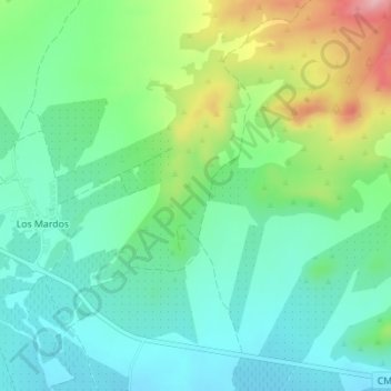
Name: La Chiclana topographic map, elevation, terrain.
Location: La Chiclana, Tobarra, Albacete, Castilla-La Mancha, España (38.61261 -1.58668 38.63261 -1.56668)
Average elevation: 2,287 ft
Minimum elevation: 2,116 ft
Maximum elevation: 2,687 ft
Other topographic maps
Click on a map to view its topography, its elevation and its terrain.
Laguna de Alboraj
España > Castilla-La Mancha > Tobarra
Laguna de Alboraj, AB-304, Tobarra, Albacete, Castilla-La Mancha, 02500, España
Average elevation: 1,978 ft