
Poti topographic map
Interactive map
Click on the map to display elevation.
About this map
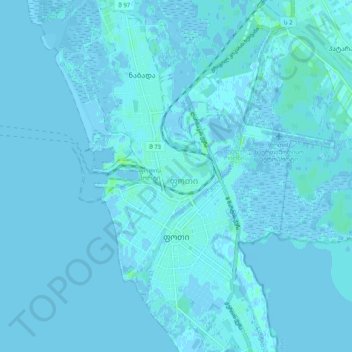
Name: Poti topographic map, elevation, terrain.
Location: Poti, Samegrelo-Upper Svaneti, 4400, Georgia (42.11728 41.65466 42.19127 41.69900)
Average elevation: 3 ft
Minimum elevation: -13 ft
Maximum elevation: 30 ft
Other topographic maps
Click on a map to view its topography, its elevation and its terrain.
Poti
Georgia > Samegrelo-Upper Svaneti > Poti
Poti, Samegrelo-Upper Svaneti, 4400, Georgia
Average elevation: 13 ft