
Cam Ranh topographic map
Interactive map
Click on the map to display elevation.
About this map
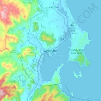
Name: Cam Ranh topographic map, elevation, terrain.
Location: Cam Ranh, Khanh Hoa province, Vietnam (11.75667 108.98861 12.07667 109.30861)
Average elevation: 561 ft
Minimum elevation: -7 ft
Maximum elevation: 4,705 ft