
Flaçà topographic map
Interactive map
Click on the map to display elevation.
About this map
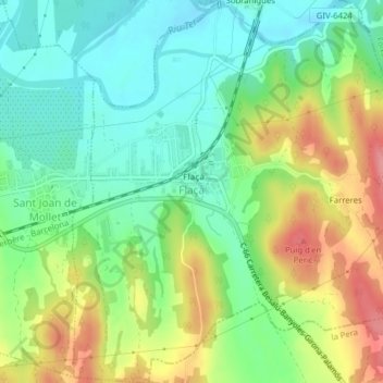
Name: Flaçà topographic map, elevation, terrain.
Location: Flaçà, Gironés, Gerona, Cataluña, España (42.03098 2.94473 42.06003 2.97999)
Average elevation: 200 ft
Minimum elevation: 69 ft
Maximum elevation: 407 ft