
Zamość topographic map
Interactive map
Click on the map to display elevation.
About this map
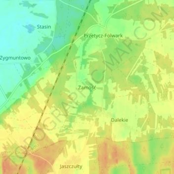
Name: Zamość topographic map, elevation, terrain.
Average elevation: 344 ft
Minimum elevation: 282 ft
Maximum elevation: 397 ft
Other topographic maps
Click on a map to view its topography, its elevation and its terrain.
Narew
Poland > Masovian Voivodeship > Wyszków County > Stary Lubiel
Narew, Stary Lubiel, gmina Rząśnik, Wyszków County, Masovian Voivodeship, 07-207, Poland
Average elevation: 285 ft
Wyszków
Poland > Masovian Voivodeship > Wyszków County
Wyszków, gmina Wyszków, Wyszków County, Masovian Voivodeship, Poland
Average elevation: 308 ft