
Dinner Plain topographic map
Interactive map
Click on the map to display elevation.
About this map
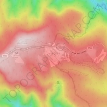
Name: Dinner Plain topographic map, elevation, terrain.
Location: Dinner Plain, Alpine Shire, Victoria, Australia (-37.04358 147.21898 -37.00358 147.25898)
Average elevation: 4,833 ft
Minimum elevation: 3,609 ft
Maximum elevation: 5,449 ft