
Belleek topographic map
Interactive map
Click on the map to display elevation.
About this map
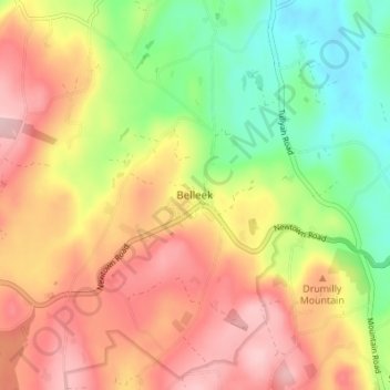
Name: Belleek topographic map, elevation, terrain.
Location: Belleek, County Armagh, Northern Ireland, United Kingdom (54.16558 -6.50757 54.20558 -6.46757)
Average elevation: 607 ft
Minimum elevation: 285 ft
Maximum elevation: 909 ft