
San Cristóbal topographic map
Interactive map
Click on the map to display elevation.
About this map
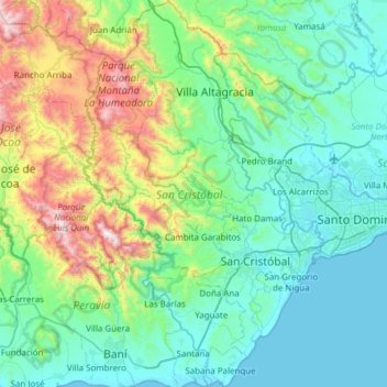
Name: San Cristóbal topographic map, elevation, terrain.
Location: San Cristóbal, Dominican Republic (18.22726 -70.38215 18.80763 -70.00205)
Average elevation: 1,099 ft
Minimum elevation: 0 ft
Maximum elevation: 5,577 ft
Other topographic maps
Click on a map to view its topography, its elevation and its terrain.
Los Cacaos
Dominican Republic > San Cristóbal
Los Cacaos, San Cristóbal, Dominican Republic
Average elevation: 2,457 ft