
Nogales topographic map
Interactive map
Click on the map to display elevation.
About this map
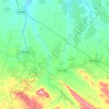
Name: Nogales topographic map, elevation, terrain.
Location: Nogales, Llanos de Olivenza, Badajoz, Extremadura, Spain (38.52987 -6.81887 38.73252 -6.68265)
Average elevation: 1,129 ft
Minimum elevation: 758 ft
Maximum elevation: 2,421 ft