
The Dell topographic map
Interactive map
Click on the map to display elevation.
About this map
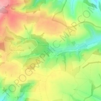
Name: The Dell topographic map, elevation, terrain.
Average elevation: 607 ft
Minimum elevation: 318 ft
Maximum elevation: 896 ft
Other topographic maps
Click on a map to view its topography, its elevation and its terrain.
Burnham-on-Sea
United Kingdom > England > Sedgemoor > Burnham-on-Sea
Burnham-on-Sea, Sedgemoor, Somerset, South West England, England, TA8 1, United Kingdom
Average elevation: 16 ft