
Carmonita topographic map
Interactive map
Click on the map to display elevation.
About this map
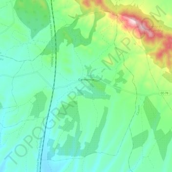
Name: Carmonita topographic map, elevation, terrain.
Location: Carmonita, Badajoz, Extremadura, 06488, Spain (39.11568 -6.41232 39.18668 -6.30754)
Average elevation: 1,319 ft
Minimum elevation: 997 ft
Maximum elevation: 2,267 ft