
Peyton topographic map
Interactive map
Click on the map to display elevation.
About this map
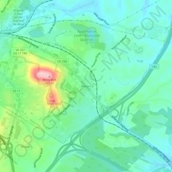
Name: Peyton topographic map, elevation, terrain.
Location: Peyton, Staunton, Virginia, 24401, United States (38.11458 -79.06308 38.15458 -79.02308)
Average elevation: 1,437 ft
Minimum elevation: 1,276 ft
Maximum elevation: 1,926 ft
Other topographic maps
Click on a map to view its topography, its elevation and its terrain.
Dogwood Hill
United States > Virginia > Staunton
Dogwood Hill, Staunton, Virginia, 24401, United States
Average elevation: 1,506 ft