
Bursa topographic map
Interactive map
Click on the map to display elevation.
About this map
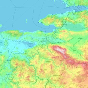
Name: Bursa topographic map, elevation, terrain.
Location: Bursa, Marmara Region, Turkey (39.59351 28.10694 40.74367 29.91004)
Average elevation: 1,342 ft
Minimum elevation: -7 ft
Maximum elevation: 8,245 ft