
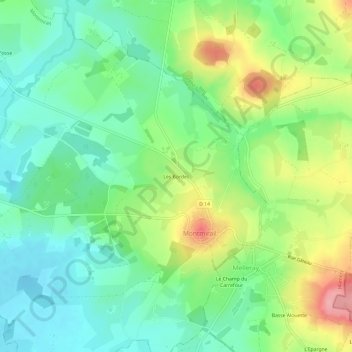
Les Bordes topographic map
Interactive map
Click on the map to display elevation.
About this map
Name: Les Bordes topographic map, elevation, terrain.
Average elevation: 538 ft
Minimum elevation: 397 ft
Maximum elevation: 794 ft
Other topographic maps
Click on a map to view its topography, its elevation and its terrain.
Montmirail
France > Pays de la Loire > Sarthe > Montmirail
Montmirail, Mamers, Sarthe, Pays de la Loire, France métropolitaine, 72320, France
Average elevation: 545 ft