
Çamardı topographic map
Interactive map
Click on the map to display elevation.
About this map
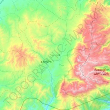
Name: Çamardı topographic map, elevation, terrain.
Location: Çamardı, Niğde, Central Anatolia Region, Turkey (37.64959 34.85169 38.06734 35.31111)
Average elevation: 6,686 ft
Minimum elevation: 3,940 ft
Maximum elevation: 12,270 ft