
Donau topographic map
Interactive map
Click on the map to display elevation.
About this map
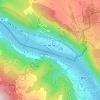
Name: Donau topographic map, elevation, terrain.
Location: Donau, Untergriesbach, Landkreis Passau, Bavaria, Germany (48.51391 13.71110 48.51824 13.72417)
Average elevation: 1,499 ft
Minimum elevation: 912 ft
Maximum elevation: 2,415 ft