
Batumi topographic map
Interactive map
Click on the map to display elevation.
About this map
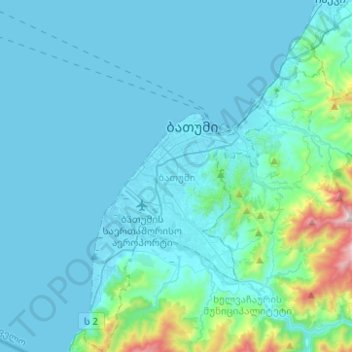
Name: Batumi topographic map, elevation, terrain.
Location: Batumi, Autonomous Republic of Adjara, Georgia (41.53124 41.55949 41.71703 41.74570)
Average elevation: 397 ft
Minimum elevation: -7 ft
Maximum elevation: 3,858 ft