
Chandrabani topographic map
Interactive map
Click on the map to display elevation.
About this map
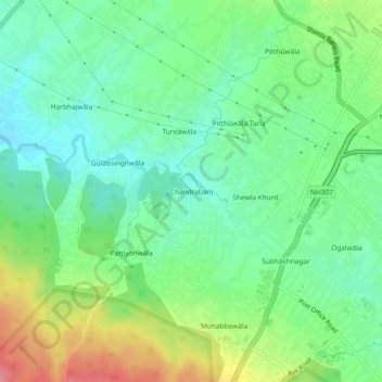
Name: Chandrabani topographic map, elevation, terrain.
Location: Chandrabani, Dehradun, Uttarakhand, 248171, India (30.26503 77.95869 30.30503 77.99869)
Average elevation: 1,991 ft
Minimum elevation: 1,893 ft
Maximum elevation: 2,175 ft