
Denham topographic map
Interactive map
Click on the map to display elevation.
About this map
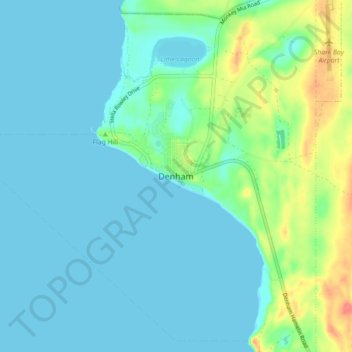
Name: Denham topographic map, elevation, terrain.
Location: Denham, Western Australia, 6537, Australia (-25.96810 113.49722 -25.88810 113.57722)
Average elevation: 39 ft
Minimum elevation: 0 ft
Maximum elevation: 184 ft