
La Redonda topographic map
Interactive map
Click on the map to display elevation.
About this map
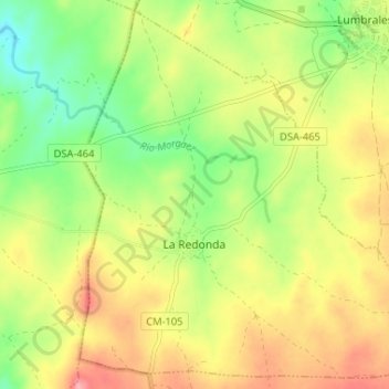
Name: La Redonda topographic map, elevation, terrain.
Location: La Redonda, Salamanca, Castile and León, 37247, Spain (40.89115 -6.76813 40.93758 -6.70309)
Average elevation: 2,221 ft
Minimum elevation: 2,051 ft
Maximum elevation: 2,405 ft