
Portbou topographic map
Interactive map
Click on the map to display elevation.
About this map
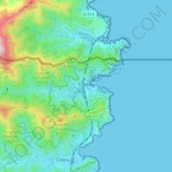
Name: Portbou topographic map, elevation, terrain.
Location: Portbou, Upper Empordà, Girona, Catalonia, 17497, Spain (42.41544 3.10155 42.43819 3.17499)
Average elevation: 318 ft
Minimum elevation: -3 ft
Maximum elevation: 1,982 ft