
和平县 topographic map
Interactive map
Click on the map to display elevation.
About this map
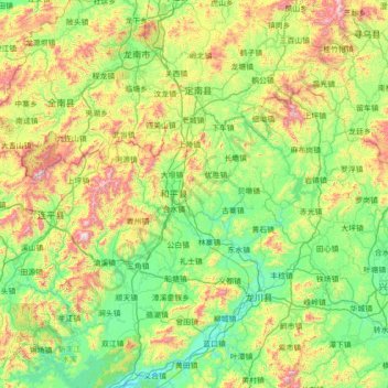
Name: 和平县 topographic map, elevation, terrain.
Location: 和平县, Heyuan City, Guangdong, China (23.80004 114.36828 25.08004 115.64828)
Average elevation: 1,152 ft
Minimum elevation: 121 ft
Maximum elevation: 4,344 ft
Other topographic maps
Click on a map to view its topography, its elevation and its terrain.
Xinyi City
Xinyi City, Maoming City, Guangdong, 525300, China
Average elevation: 1,001 ft
Nanhu Sub-district
China > Guangdong > Shenzhen City > Nanhu Sub-district
Nanhu Sub-district, Luohu District, Shenzhen City, Guangdong, 518000, China
Average elevation: 95 ft
Xiashan District
Xiashan District, Zhanjiang City, Guangdong, China
Average elevation: 72 ft