
Graben System Haarbach (Quelllauf ohne Anschluß) topographic map
Interactive map
Click on the map to display elevation.
About this map
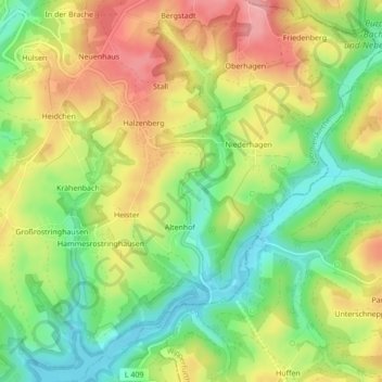
Name: Graben System Haarbach (Quelllauf ohne Anschluß) topographic map, elevation, terrain.
Average elevation: 778 ft
Minimum elevation: 594 ft
Maximum elevation: 984 ft
Other topographic maps
Click on a map to view its topography, its elevation and its terrain.
Well
Germany > North Rhine-Westphalia > Wermelskirchen > Well
Well, Wermelskirchen, Rheinisch-Bergischer Kreis, North Rhine-Westphalia, 42929, Germany
Average elevation: 935 ft