
Slamet topographic map
Interactive map
Click on the map to display elevation.
About this map
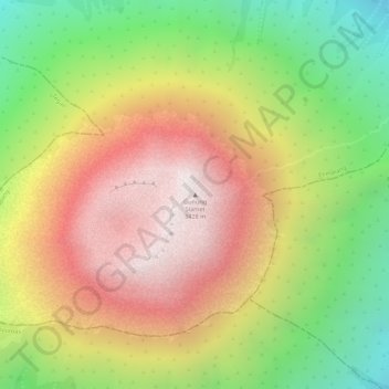
Name: Slamet topographic map, elevation, terrain.
Location: Slamet, Pemalang, Central Java, Indonesia (-7.23914 109.21988 -7.23904 109.21998)
Average elevation: 9,642 ft
Minimum elevation: 7,861 ft
Maximum elevation: 11,194 ft
Other topographic maps
Click on a map to view its topography, its elevation and its terrain.
Pemalang
Indonesia > Central Java > Pemalang
Pemalang, Central Java, 52361, Indonesia
Average elevation: 26 ft