
Garam-dong topographic map
Interactive map
Click on the map to display elevation.
About this map
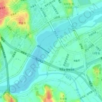
Name: Garam-dong topographic map, elevation, terrain.
Location: Garam-dong, Hansol-dong, Sejong, 30065, South Korea (36.46299 127.23665 36.47955 127.25654)
Average elevation: 75 ft
Minimum elevation: 23 ft
Maximum elevation: 246 ft