
Sonamarg topographic map
Interactive map
Click on the map to display elevation.
About this map
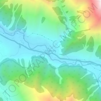
Name: Sonamarg topographic map, elevation, terrain.
Location: Sonamarg, Kangan, Ganderbal district, Jammu and Kashmir, India (34.28239 75.27656 34.32239 75.31656)
Average elevation: 10,066 ft
Minimum elevation: 8,658 ft
Maximum elevation: 13,911 ft
The hill station is situated in the Kashmir Valley, at an altitude of 2,730 metres (8,960 ft) and is close to some of the valley's tallest peaks, alongside the Machoi Glacier, Sirbal Peak, Kolahoi Peak, Amarnath Peak and Machoi Peak. Combined with the alpine meadows that bloom in the summer as well as rivers and lakes stocked with fish, Sonamarg is a notable tourist destination in Jammu and Kashmir.