
Nueva Irlanda topographic map
Interactive map
Click on the map to display elevation.
About this map
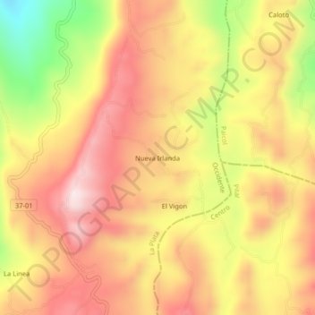
Name: Nueva Irlanda topographic map, elevation, terrain.
Location: Nueva Irlanda, La Plata, Occidente, Huila, Colombia (2.33400 -75.85841 2.37400 -75.81841)
Average elevation: 5,354 ft
Minimum elevation: 4,413 ft
Maximum elevation: 5,978 ft