
Summerhill Reserve topographic map
Interactive map
Click on the map to display elevation.
About this map
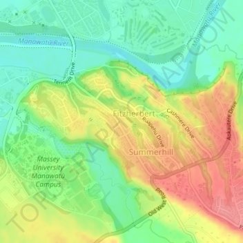
Name: Summerhill Reserve topographic map, elevation, terrain.
Average elevation: 180 ft
Minimum elevation: 62 ft
Maximum elevation: 322 ft
Other topographic maps
Click on a map to view its topography, its elevation and its terrain.
Palmerston North
New Zealand > Palmerston North
Palmerston North, Palmerston North City, Manawatu-Whanganui, 4440, New Zealand
Average elevation: 387 ft
Pool
New Zealand > Palmerston North
Pool, Russell Street, Milson, Palmerston North, Palmerston North City, Manawatu-Whanganui, 4414, New Zealand
Average elevation: 121 ft