
Laghouat topographic map
Interactive map
Click on the map to display elevation.
About this map
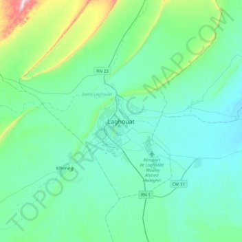
Name: Laghouat topographic map, elevation, terrain.
Location: Laghouat, Laghouat District, Laghouat, 03000, Algeria (33.64635 2.72086 33.96635 3.04086)
Average elevation: 2,687 ft
Minimum elevation: 2,369 ft
Maximum elevation: 4,469 ft
Other topographic maps
Click on a map to view its topography, its elevation and its terrain.