
Valley Falls topographic map
Interactive map
Click on the map to display elevation.
About this map
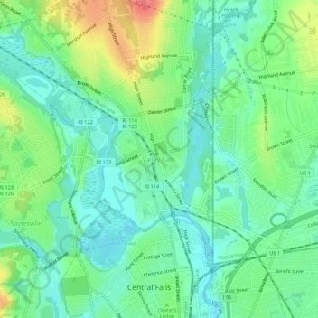
Name: Valley Falls topographic map, elevation, terrain.
Average elevation: 92 ft
Minimum elevation: 20 ft
Maximum elevation: 246 ft
Other topographic maps
Click on a map to view its topography, its elevation and its terrain.
Diamond Hill
United States > Rhode Island > Providence County > Cumberland
Diamond Hill, Cumberland, Providence County, Rhode Island, 02864, United States
Average elevation: 262 ft