
Crestwood topographic map
Interactive map
Click on the map to display elevation.
About this map
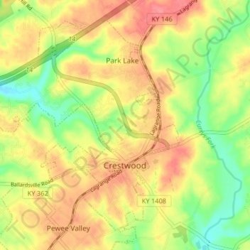
Name: Crestwood topographic map, elevation, terrain.
Location: Crestwood, Oldham County, Kentucky, United States (38.31016 -85.52390 38.35352 -85.45845)
Average elevation: 732 ft
Minimum elevation: 600 ft
Maximum elevation: 843 ft
Other topographic maps
Click on a map to view its topography, its elevation and its terrain.
Oldham
United States > Kentucky > Oldham County
Oldham, Oldham County, Kentucky, 47104, United States
Average elevation: 686 ft
La Grange
United States > Kentucky > Oldham County
La Grange, Oldham County, Kentucky, 40031, United States
Average elevation: 807 ft