
Cotas topographic map
Interactive map
Click on the map to display elevation.
About this map
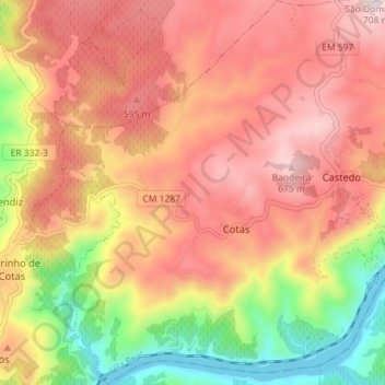
Name: Cotas topographic map, elevation, terrain.
Average elevation: 1,440 ft
Minimum elevation: 253 ft
Maximum elevation: 2,306 ft
Other topographic maps
Click on a map to view its topography, its elevation and its terrain.
Castedo
Portugal > Norte > Castedo e Cotas
Castedo, Castedo e Cotas, Alijó, Vila Real, Douro, Norte, Portugal
Average elevation: 1,286 ft