
Mandailles-Saint-Julien topographic map
Interactive map
Click on the map to display elevation.
About this map
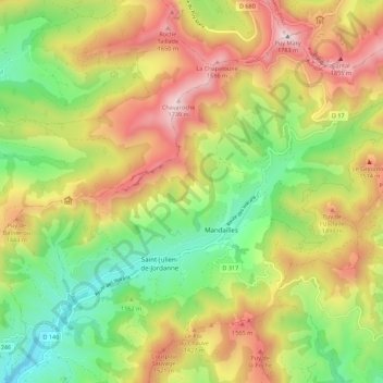
Name: Mandailles-Saint-Julien topographic map, elevation, terrain.
Average elevation: 4,078 ft
Minimum elevation: 2,651 ft
Maximum elevation: 5,840 ft