
Kasaragod topographic map
Interactive map
Click on the map to display elevation.
About this map
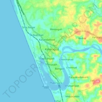
Name: Kasaragod topographic map, elevation, terrain.
Location: Kasaragod, Kasaragod district, Kerala, India (12.46203 74.94999 12.54203 75.02999)
Average elevation: 62 ft
Minimum elevation: -10 ft
Maximum elevation: 292 ft