
Kakinada topographic map
Interactive map
Click on the map to display elevation.
About this map
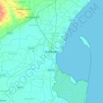
Name: Kakinada topographic map, elevation, terrain.
Average elevation: 23 ft
Minimum elevation: -7 ft
Maximum elevation: 325 ft
Kakinada is located at 16°56′N 82°13′E / 16.93°N 82.22°E / 16.93; 82.22. The 82-degrees east longitude passes through the city. It has an average elevation of 2 metres (6 ft), and many areas of the city are below sea level.
Other topographic maps
Click on a map to view its topography, its elevation and its terrain.
Dharmavaram
India > Andhra Pradesh > Kakinada
Dharmavaram, Kakinada, East Godavari, Andhra Pradesh, 533001, India
Average elevation: 135 ft