
New Plymouth topographic map
Interactive map
Click on the map to display elevation.
About this map
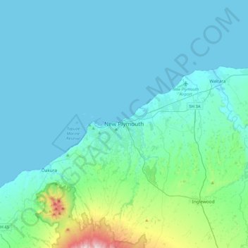
Name: New Plymouth topographic map, elevation, terrain.
Average elevation: 302 ft
Minimum elevation: -3 ft
Maximum elevation: 2,736 ft
Other topographic maps
Click on a map to view its topography, its elevation and its terrain.
Ōakura
New Zealand > Taranaki > New Plymouth District
Ōakura, New Plymouth District, Taranaki, 4314, New Zealand
Average elevation: 243 ft
Waitara
New Zealand > Taranaki > New Plymouth District
Waitara, New Plymouth District, Taranaki, 4320, New Zealand
Average elevation: 92 ft