
Vlissingen topographic map
Interactive map
Click on the map to display elevation.
About this map
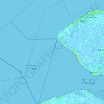
Name: Vlissingen topographic map, elevation, terrain.
Location: Vlissingen, Zeeland, Netherlands (51.37297 3.30794 51.61641 3.64751)
Average elevation: 0 ft
Minimum elevation: -13 ft
Maximum elevation: 108 ft
Topographic map of Vlissingen (city), Sept. 2014