
Cumanacoa topographic map
Interactive map
Click on the map to display elevation.
About this map
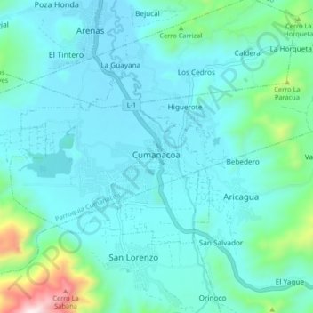
Name: Cumanacoa topographic map, elevation, terrain.
Location: Cumanacoa, Municipio Montes, Sucre State, Venezuela (10.21044 -63.95984 10.29044 -63.87984)
Average elevation: 1,096 ft
Minimum elevation: 653 ft
Maximum elevation: 3,750 ft