
Vila Verde topographic map
Interactive map
Click on the map to display elevation.
About this map
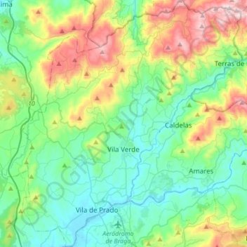
Name: Vila Verde topographic map, elevation, terrain.
Location: Vila Verde, Braga, Portugal (41.56889 -8.54736 41.77063 -8.30619)
Average elevation: 764 ft
Minimum elevation: 62 ft
Maximum elevation: 2,618 ft