
Markelo topographic map
Interactive map
Click on the map to display elevation.
About this map
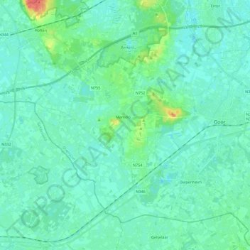
Name: Markelo topographic map, elevation, terrain.
Location: Markelo, Hof van Twente, Overijssel, Netherlands (52.17714 6.41631 52.28350 6.63863)
Average elevation: 49 ft
Minimum elevation: 23 ft
Maximum elevation: 177 ft