
Develier topographic map
Interactive map
Click on the map to display elevation.
About this map
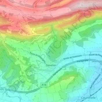
Name: Develier topographic map, elevation, terrain.
Location: Develier, District de Delémont, Giura, 2802, Svizzera (47.34624 7.24588 47.38024 7.31487)
Average elevation: 1,988 ft
Minimum elevation: 1,398 ft
Maximum elevation: 3,091 ft