
Voerendaal topographic map
Interactive map
Click on the map to display elevation.
About this map
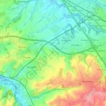
Name: Voerendaal topographic map, elevation, terrain.
Location: Voerendaal, Limburg, Netherlands, The Netherlands (50.83966 5.86149 50.90484 5.96936)
Average elevation: 407 ft
Minimum elevation: 243 ft
Maximum elevation: 712 ft
Dutch topographic map of the municipality of Voerendaal, June 2015