
Ōtaki topographic map
Interactive map
Click on the map to display elevation.
About this map
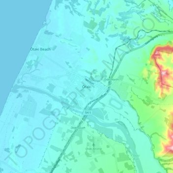
Name: Ōtaki topographic map, elevation, terrain.
Average elevation: 92 ft
Minimum elevation: 0 ft
Maximum elevation: 761 ft
Other topographic maps
Click on a map to view its topography, its elevation and its terrain.
Rangiora River
New Zealand > Wellington > Kapiti Coast District
Rangiora River, Reikorangi, Kapiti Coast District, Wellington, 5391, New Zealand
Average elevation: 394 ft