
Retie topographic map
Interactive map
Click on the map to display elevation.
About this map
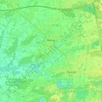
Name: Retie topographic map, elevation, terrain.
Location: Retie, Turnhout, Antwerp, Flanders, 2470, Belgium (51.21818 5.01607 51.29793 5.15905)
Average elevation: 75 ft
Minimum elevation: 43 ft
Maximum elevation: 125 ft