
Galmaarden topographic map
Interactive map
Click on the map to display elevation.
About this map
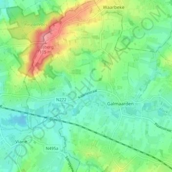
Name: Galmaarden topographic map, elevation, terrain.
Location: Galmaarden, Halle-Vilvoorde, Flemish Brabant, Flanders, Belgium (50.73482 3.93104 50.77972 3.98624)
Average elevation: 138 ft
Minimum elevation: 39 ft
Maximum elevation: 354 ft