
Destelbergen topographic map
Interactive map
Click on the map to display elevation.
About this map
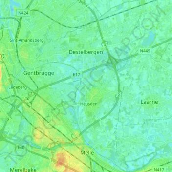
Name: Destelbergen topographic map, elevation, terrain.
Location: Destelbergen, East Flanders, Flanders, Belgium (50.99308 3.75607 51.08247 3.84447)
Average elevation: 23 ft
Minimum elevation: -10 ft
Maximum elevation: 92 ft